About the Appalachian Trail
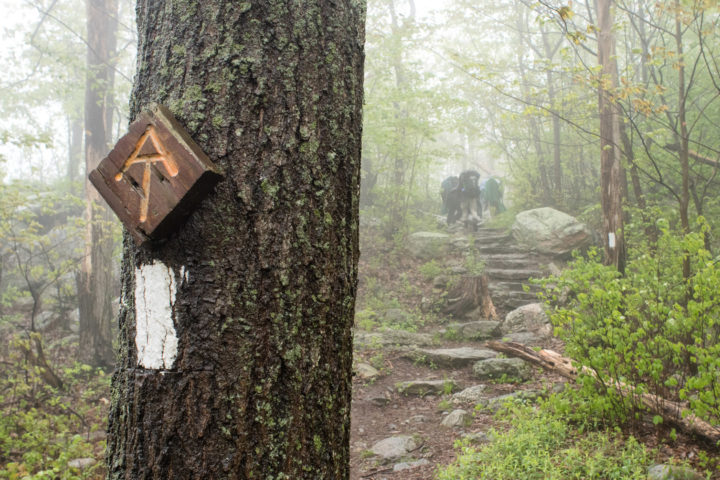
 The Appalachian National Scenic Trail is the longest hiking-only footpath in the world, measuring 2,198.4 miles in length in 2023. The Trail travels through fourteen states along the crests and valleys of the Appalachian Mountain Range, from its southern terminus at Springer Mountain, Georgia, to the northern terminus at Katahdin, Maine.
Known as the “A.T.”, more than 3 million people visit the Trail every year and more than 3,000 people attempt to “thru-hike” the entire footpath in a single year. People from across the globe are drawn to the A.T. for a variety of reasons, such as reconnecting with nature, escaping the stress of city life, meeting new people or deepening old friendships, or experiencing a simpler life.
Completed in 1937, the A.T. is a unit of the National Park System. It is managed under a unique partnership between the public and private sectors led by the Appalachian Trail Conservancy.
Fun Facts
- The Trail is 2,198.4 miles long in 2023, passing through 14 states. This distance typically changes slightly each year due to footpath relocations and more precise measurement techniques.
- It takes roughly 5 million steps to hike the entire A.T. — whether that is over a series of section hikes or one “thru-hike” in a single year.
- Thousands of volunteers contribute roughly 240,000 hours to the A.T. every year.
- More than 250 three-sided shelters exist along the Trail.
- Virginia is home to the most miles of the Trail (about 550), while West Virginia is home to the least (about 4).
- Maryland and West Virginia are the easiest states to hike; New Hampshire and Maine are the hardest.
- The total elevation gain of hiking the entire A.T. is equivalent to climbing Mt. Everest 16 times.
- The A.T. passes through six National Park Service units, including:
- The A.T. also traverses eight National Forests, which include:
- The A.T. also travels through two wildlife refuges:
- The A.T. is home to an impressive diversity of plants and animals. Some animals you may see include black bears, moose, porcupines, snakes, woodpeckers, and salamanders. Some plants you may encounter include jack-in-the-pulpit, skunk cabbage, and flame azalea.
Hikers
- More than 3 million visitors walk a portion of the A.T. each year.
- The A.T. has hundreds of access points and is within a few hour’s drive of millions of Americans, making it a popular destination for day-hikers.
- “Thru-hikers” walk the entire Trail in a continuous journey. “Section-hikers” piece the entire Trail together over years. “Flip-floppers” thru-hike the entire trail in discontinuous sections to avoid crowds or extremes in weather, or to start on easier terrain.
- 1 in 4 who attempt a thru-hike successfully completes the journey. See the latest thru-hiking statistics.
- Most thru-hikers walk north, starting in Georgia in spring and finishing in Maine in fall, taking an average of 6 months.
- Foods high in calories and low in water weight, such as Snickers bars and Ramen Noodles, are popular with backpackers, who can burn up to 6,000 calories a day.
- Hikers usually adopt “trail names” while hiking the Trail. They are often descriptive or humorous. Examples are “Eternal Optimist,” “Thunder Chicken,” and “Crumb-snatcher”.
EXPLORE THE TRAIL
About the Appalachian Trail Conservancy

The mission of the Appalachian Trail Conservancy (ATC) is to protect, manage, and advocate for the Appalachian National Scenic Trail.
Established in 1925, the ATC leads the effort to protect, maintain and celebrate the A.T. We are part of a unique cooperative-management system, working with numbers of local, state and federal partners to ensure greater protections for the Trail. Our partners include the National Park Service, the U.S. Forest Service, dozens of state agencies and 31 local Trail-maintaining clubs.
The ATC is largely funded by its more than 30,000 members and 600,000 supporters located throughout all 50 states and in more than 15 countries. Their support ensures that the one-of-a-kind A.T. hiking experience is protected from development, increasing use of the outdoors and other threats.
An all-volunteer staff in Washington, D.C., managed the organization for its first four decades. With central offices in Harpers Ferry, West Virginia, a quarter-mile from the Trail since 1972, the ATC today has a governing body of 17 volunteers, more than 30,000 individual members, an annual budget of $14 million, a full-time staff of about 60 (along with more than a dozen part-time and seasonal employees), and total assets of about $17 million, including about 40 properties along the Trail.
OUR MISSION & VALUES